Wednesday, January 25, 2012

Yalta

The narrow strip of sea coast on the south side of the Crimean peninsula has the warmest weather in all of Ukraine with a Mediterranean climate.  But they do get snow occasionally, and that was our weather in January, 2012!  This is the view from the road as we came into the greater Yalta area.
The coast land rises from the sea shore quite steeply to a parallel mountain range about 2000 feet high.  The main highway ranges along the foothills and the small cities are below with small narrow streets and sloping properties.   Those who don’t want to lounge on the beach (when it is sunny and warm!) are happy to hike in the mountains!  

This is the tourist "icon" for the Crimea--the "Swallow's Nest". It was built in 1912 by a German oil baron as a gift to his mistress.  Construction was stopped by war, it was ruined by an earthquake in 1927, and rebuilt in the 1970’s.  We hopped off the bus to take photos.  We didn’t walk down because there are just more souvenir shops and an expensive Italian restaurant in the building.  I bought a couple of items in a roadside souvenir shop and we had some soup in a nice restaurant while waiting for the next bus!
This mountain is said to look like a bear taking a drink from the Black Sea!  (The angle of the photo could have been better to see the "head" properly)
In the 19th century, Yalta became a fashionable resort for the Russian aristocracy and gentry.  In 1898 Anton Chekhov bought a plot of land on the outskirts of Yalta and built a villa there, into which he moved with his mother and sister the following year. He planted trees and flowers in his large garden area, kept dogs and tame cranes, and received guests such as Leo Tolstoy and Maxim Gorky. Yalta is the setting for Chekhov's short story, "The Lady with the Dog", and such prominent plays as The Three Sisters were written in Yalta, which he loved.  This is a model of the property.  We saw the area all in snow!

Rachmaninoff was a friend and guest and played on this piano! 
This is one of the cozy guest sitting/bedrooms.
This is Checkov's study with his desk (under glass) at the left.  There is an alcove behind it where he sat so there were no drafts to chill him (he was suffering with tuberculosis).  The fireplace is directly across from his  writing desk.
Checkov was a trained doctor and these are some of his medical books.  Chekhov practiced as a doctor throughout most of his literary career though he made little money from it and treated the poor free: "Medicine is my lawful wife", he once said, "and literature is my mistress."  Actually, he made his money as a writer of short stories and plays.
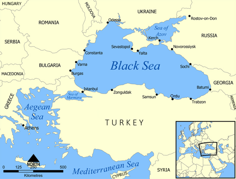
Yalta is a seaport. 
 Here are men spending a snowy day trying to catch fish!
Others were undecorating the holiday tree!
We enjoyed a visit to the nearby Nikita Botanical Gardens that were established in 1812!
Much of the snow had melted and flowers were trying to survive, having bloomed in mild weather before the winter storm.  There was even the sweet smell of blossoms in some places.
We wandered through acres of trees and foliage.
And finally found the Cedar of Lebanon trees we particularly wanted to see.  This is what the needles look like, and then a tree
We saw other interesting old trees like this Oriental Plane tree with large maple-like leaves
And a Cork Oak tree--you can see where some cork has been pried out of the thick bark.

We also enjoyed the orchid greenhouse with beautiful species of orchids and bromeliads.

We're leaving the parking area in our little Skoda rental car
These are views in Alushta, the last place we stayed, on the evening we arrived.
Daybreak the following morning from our hotel room
The snow was mostly melted but the wind was creating waves.
We began the drive away from the coast and back "up" to Simferopol.
And rode the overnight train back to Kyiv.


Tuesday, January 24, 2012

Sevastopol

Unusual snowy Winter weather made our visit to Sevastopol more interesting!  It was still the extended holiday season and felt like it!
After Russia annexed the Crimea, in 1783 Catherine the Great ordered a port city and a Black Sea fleet built.  This is a photo of model ships of that period.

In the 1850's with the Ottomon Empire declining, Russia on the east and European powers on the west tested each other, until the Crimean War broke out, with most battles surrounding the Black Sea.  When the European Allies (Britain, France, Sardonia, and Turkey) moved naval assets into the Black Sea and attacked Sevastopol, it was the beginning of one of the most notable events involving the city: the Siege of Sevastopol (1854–1855) . Despite its efforts, the Russian army had to leave its stronghold and evacuate over a pontoon bridge to the north shore of the inlet. The Russians had to sink their entire fleet to prevent it from falling into the hands of the enemy and at the same time to block the entrance of the Allied ships into the inlet. When enemy troops entered Sevastopol, they were faced with the ruins of a formerly glorious city.  This is the famous Monument to the Scuttled Ships looking across the bay to the north shore.
The Russians retreated to the interior but did not give up.  They advanced on the hills surrounding Balaclava, an Allied supply port.  
The British were afraid they would come down into the port and defended with a "thin red line" of Highlanders. In an attempt to push the advancing Russians back, a brigade of cavalry was ordered to advance in the valley above.  Though surrounded by Russian 
infantry, artillery, and cavalry, 673 mounted their horses and rode courageously to their deaths (fewer than 200 survived) as memorialized by Tennyson in his “Charge of the Light Brigade”  This photo was taken from the hill where the ill-advised British commander directed the battle.

The siege of Sevastopol lasted 349 days, with continued battles and no one gaining advantage.  The war ended with no victory for anyone, only a peace treaty that left political questions and tensions that lead to WW I.

In World War II  Sevastopol withstood intensive bombardment by the Germans in 1941–1942, during the Axis siege which lasted for 250 days before it fell in July 1942. It was liberated by the Red Army on May 9, 1944 and was awarded with the Hero City title a year later.  This giant concrete Soviet monument honors the World War II (known in the former-Soviet Union as the Great Patriotic War) defenders of Sevastopol from the years 1941-42. Below the giant stylized fighting man is the eternal flame as well as a giant marble wall with the name of every sea, air and land unit of the Black Sea Fleet that defended Sevastopol from the Nazi onslaught.
To the left of the eternal flame is a park with a marble marker for every city declared a “hero city” during WWII.

After World War II, Sevastopol was entirely rebuilt, which was mostly finished by the mid-1950s.  Because it continued to be the base of the Black Sea Fleet, it was a "closed city" meaning that any non-residents had to apply to the authorities for a temporary permit to visit the city and it was directly subordinate to the central Russian authorities.  Balaclava was incorporated into Sevastopol in 1957

BALACLAVA
Homer’s Odyssey mentions this port as a sheltered pirate hideout where ships were lured (3000 years ago!).  A tight fitting silly-looking full hood hat was knitted by British women to keep soldiers in Balaclava wam in the Crimean war.  In 1854 the British navy was sheltering too many ships in the bay, and a bad November storm sank many. 


An underwater cave was the beginning of a secret submarine base the Soviets created in 1957-61 to repair (one dry dock area) and resupply submarines as well as shelter nuclear missiles, 7 middle sized and 9 small sized submarines, and necessary personnel (3000 people for 30 days!) against a bomb 10X size of Hiroshima!  This shows the facility's layout.
The entrance tunnel
The dry dock area to the left (water not pumped out) and a small model submarine of the type serviced displayed up in front.  The main tunnel waterway is to the right under the supports.
Tight heavy doors to protect against blasts
After the fall of the USSR, Ukraine declared independance.  There followed years of disagreements and negotiations until 1997 when Russia finally allow the Crimea to be an autonomous republic in the Ukraine.  The Black Sea Fleet was divided among the two nations and all nuclear capabilities were removed.  New submarines did not fit into the tight quarters and this site was turned over to Ukraine and into a museum.  This photo (under glass) of a joint Russian/Ukrainian navy parade in Sevastopol shows the two differing flags.  The Russian navy kept the St Andrew's cross.  The Ukrainian navy uses the St George cross with the Ukrainian yellow and blue in the upper left corner.
Here are photos of other naval flags on display at the museums of the two navies starting with the old USSR naval flags with star and sickle and a blue base


Monday, January 23, 2012

The Crimea


We left Kyiv on the overnight train to Simferapol Monday, Jan 16.  I talked to our train car attendant and he showed me the route on the west side of the Dneiper River southeast until crossing over at Dnipropetrovsk, then to Zaporizhzhaya and then south.  We could have gone on the train as far as Sebvastopol, but could only rent a car in the capital, Simferopol.  We left at 8:20p so we were traveling through the dark of night until morning when we could see some of the farm lands in the south, then the crossing over causeways to the peninsula, arriving after 10a.  
There was some snow all the way south!  This was our arrival Tuesday morning at 10:20a at the beautiful Simferopol train station.
We took a bus to the airport where we picked up our rental car.
This map will help track our trip around the "golden loop or ring" of Crimea: southwest to Sevastopol, around the southern coast in the greater Yalta area as far as Alushta, and then back up to Simferopol.
For a better idea of how the Crimea has been a key to many trade routes and political conquests, one needs to see the location in the Mediterranean area. [I'm grateful to Wikipedia for the maps]
 File:Black Sea map.png
CHERSONESOS
The earliest established city in Crimea was at Chersonesos by the Greeks in 528 BC who came from a city across and along the south coast of the Black sea (present day Turkey). It is located along the coast at Sevastopol.  Eventually several other port cities on the north side of the Black Sea were established.  Chersonesos was a big city port, surrounded by walls.
 Where the Vladimir Cathedral (obvious in the background) now stands was the city center in Greek and Roman times with porticos and columns. 
In the first centuries AD Chersonesos came under Rome and then later Byzantium rule.  Constantine adopted Christianity as his state religion and it was exported all over the Byzantine empire. In 988 AD Vladimir traveled to Chersonesos to be baptized and married. He then took his religion and wife to Kyiv and his Kyiv Rus state.  All residents of Kyiv were forced to be baptized in the Dnieper! 
To commemorate the baptizing of Vladimir, in 1861 in the presence of Alexander II the foundation of this cathedral was laid.  It was completed in 1891 and then closed in Soviet times.  Blown up by Nazis in 1944, restoration work started in 1999.   
Christian traditions, including writings of Eusebius quoting Origon, say the apostle Andrew preached all along the coasts of the Black Sea.  Legend has it that he traveled up the Dnieper River and reached the future location of Kyiv in 55 AD, where he erected a cross on the site where the St. Andrew's Church of Kiev currently stands, and prophesied the foundation of a great Christian city, Jerusalem of the Russian land.  Upon returning to Asia Minor, he was executed by the Romans by crucifixion being bound (not nailed) on a cross.  Supposedly at his request, it was X shaped, not the type used for Christ's death, and that X-shaped cross became known as the St Andrew's cross, used in flags like the Russian navy, and Scotland's national flag!  
In middle of 15th century, after several changes of political control, and 2000 years, Chersonesos ceased to exist!  It is the largest site of Greek ruins in Crimea.   

BAKHCHISARAI
The area of Crimea was conquered and controlled by many different ethnic groups.  In the 1200's the Mongols came and were succeeded by the Golden Horde.  As many of these people settled instead of being nomads, mixed with the other ethnic groups, especially Turkic peoples, and the Golden Horde was defeated, the Crimean Tatars became a people and founded an independant Khanate.  They had close relations and eventually were submissive to the Ottoman Empire.  They adopted Islam in the 13th century.  Bakchisarai was established as the capital with the building of the Khan's Palace in 1551.  It was added to over 200 years by succeeding Khans and many mosques were also built.  We were not able to go inside the complex of buildings because it was closed for cleaning (except for a tour group that arrived after us and got in!)  So I have added some images from Google after this one we took of the "workers" outside the gate!  

Because they were Muslims, who often raided the northern mainland capturing people and then selling them off to the Turks as slaves, Tatars were not loved by the Ukrainians/Russians. Under Catherine the Great’s rule, they were not treated well and most moved to Turkey.  She then gave away their land to wealthy friends and the Crimea became the sunny vacation spot for Russian nobility.  During the 1900’s the Crimea was occupied by various empires, until reverting back to Soviet Russia.  Stalin accused Tatars of being disloyal and deported them to work in Uzbekistan, with half dying in the first year.  Thus land again came under Soviet control.  Sanatoriums were built and vacations were given those whom the Communists wanted to reward. There were, in fact, few other places that Soviet citizens could come for a seaside holiday, as foreign travel was forbidden to all but a handful.  After the fall of the USSR, Crimea became an autonomous republic in Ukraine.  Bakhchisarai is the heart of Tatar repatriation.


Nearby and up the canyon are are an old Orthodox monastery and across the canyon a city of Karaite Jews.  They are built in natural caves in the weathered limestone.  We did not hike up to these areas and the photos are from Google.  It is interesting that the Muslims, Jews, and Orthodox Christians all respected one another.  Crimea takes its name from the capital city of Golden Horde time meaning "my hill".
Ancient cave city Chufut-Kale - Древний пещерный город Чуфут-Кале